


Voting District 0006, Clay County, Texas
About
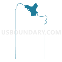
Outline

Summary
| Unique Area Identifier | 671485 |
| Name | Voting District 0006 |
| County | Clay County |
| State | Texas |
| Area (square miles) | 58.04 |
| Land Area (square miles) | 57.81 |
| Water Area (square miles) | 0.23 |
| % of Land Area | 99.60 |
| % of Water Area | 0.40 |
| Latitude of the Internal Point | 34.08043890 |
| Longtitude of the Internal Point | -98.17061210 |
Maps


Graphs
Select a template below for downloading or customizing gragh for Voting District 0006, Clay County, Texas


Neighbors
Neighoring Voting District (by Name) Neighboring Voting District on the Map
- Voting District 0008, Clay County, TX
- Voting District 0014, Clay County, TX
- Voting District 0027, Clay County, TX
- Voting District 3, Jefferson County, OK
- Voting District 6, Jefferson County, OK
- Voting District 6, Cotton County, OK
Top 10 Neighboring County Subdivision (by Population) Neighboring County Subdivision on the Map
- Waurika CCD, Jefferson County, OK (2,835)
- Byers-Petrolia CCD, Clay County, TX (2,237)
- South Jefferson CCD, Jefferson County, OK (1,687)
- Temple CCD, Cotton County, OK (1,252)
Top 10 Neighboring Place (by Population) Neighboring Place on the Map
Top 10 Neighboring Unified School District (by Population) Neighboring Unified School District on the Map
- Henrietta Independent School District, TX (5,771)
- Waurika Public Schools, OK (2,755)
- Petrolia Independent School District, TX (2,157)
- Temple Public Schools, OK (1,333)
- Ryan Public Schools, OK (1,137)
- Byers Independent School District, TX (717)
Top 10 Neighboring State Legislative District Lower Chamber (by Population) Neighboring State Legislative District Lower Chamber on the Map
Top 10 Neighboring State Legislative District Upper Chamber (by Population) Neighboring State Legislative District Upper Chamber on the Map
Top 10 Neighboring 111th Congressional District (by Population) Neighboring 111th Congressional District on the Map
Top 10 Neighboring Census Tract (by Population) Neighboring Census Tract on the Map
- Census Tract 303.01, Clay County, TX (4,683)
- Census Tract 3718, Jefferson County, OK (2,835)
- Census Tract 8712, Cotton County, OK (2,399)
- Census Tract 3717, Jefferson County, OK (1,687)
Top 10 Neighboring 5-Digit ZIP Code Tabulation Area (by Population) Neighboring 5-Digit ZIP Code Tabulation Area on the Map
- 76365, TX (4,831)
- 76305, TX (4,746)
- 73573, OK (2,551)
- 73565, OK (1,092)
- 76377, TX (802)
- 76357, TX (712)
- 73548, OK (519)